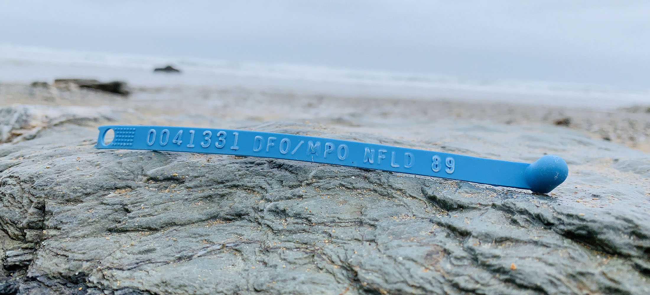
The Fish Tag Citizen Science project aims to create a database of tags that have been found and map where they start and where they end up, using plastic pollution to map currents as well as to think about the scales and currents of accountability when plastic is a global pollutant. We have found that plastics are moving from Newfoundland and Labrador, Canada, to the rest of the world. All the data for this project has been collected by beach combers and clean up crews when they find DFO fishing tags on shorelines. Thank you!
This project has completed phase 1, the pilot stage. Nadia Duman, a graduate student in CLEAR, has mapped over 200 fish tags as they move from the Atlantic region of Canada to the west coast of Europe. It’s clear that plastic waste travels in a certain direction! More details are in CLEAR’s Regional report on plastic pollution in Newfoundland and Labrador, 1962-2019.

We will do another round of analysis in a few years. We’ll need more tags for that. If you want to join this project, next time you are on the beach …
- Look for fishing tags! They are brightly coloured strips of plastic that have text and a number written on them. We’re looking for ones from “NL” but any that come from Canada are of interest.
- Note the details printed on the tag, as well as the date you found it, and the name of the beach or body of water.
- Email us the data and a photo.
If you have a lot of tags from a shoreline clean up, you can mail us the tags and we’ll log the information. Email us to arrange shipping and info about collection date/location.
You can contact us at clearlab@mun.ca.
1 Comment
Comments are closed.